![]()


This walk: 2019-7-25. Princetown, Plume of Feathers, Fox Tor Cafe, 1908 drinking fountain no. 1, cattle crusher (former Dousland GWR levelcrossing gate), HM Prison, Devonport Leat, Bachelors Hall, Blackbrook River, Bullpark, Conchie Road, Blakey Tor, Crock of Gold cairn circle and cist, pineapple weed, Prince of Wales public house, 1908 drinking fountain no. 2.
Walk details below - Information about the route etc.
Previous walks in this area: 15 July 2009, 5 November 2014
Reconnaissance walks: 28 June 2019 (hot, gale, no GPS), 2 July 2019, 21 July 2019
Google Satellite map + GPS track of the walk
Prince's Town was built by Thomas Tyrwhitt (1762-1833) and named in honour of the Prince of Wales, to whom he was Private Secretary. He built roads across Dartmoor and many other features - he was one of the Georgian "Improvers", although he eventually fell foul of the local climate that did little to encourage farming and crop-growing. He was MP for Okehampton (1796-1802), Portarlington (1802-1806) and Plymouth (1806-1812). He built the war prison in 1809 for French prisoners taken in the Napoleonic wars and for Americans taken in the 1812 war. He also built the Plymouth & Dartmoor Railway, a horse-dawn tramway initially, converted to steam later by the GWR. Another link.

Duchy Square scene, Princetown, with the Duchy Hotel (right) and The Plume of Feathers public house (left) .....

The Plume of Feathers Inn .....

Princetown's oldest building and a coaching house since 1785.


One of two 1908 now-defunct drinking fountains, this one is beside Two Bridges Road in front of Oakery Crescent; the other is beside the Prince of Wales public house on the road to the prison .....

Self-explanatory notice attached to the fountain .....

TR 1908 DC, The Gift of RH Hooker Esq. TRDC - Tavistock Rural District Council. RH Hooker - perhaps this person? No real evidence, except that in this Wikipedia article: "As a baby RHH was quite poorly and his father and Darwin exchanged anxious letters over his health".

The drinking head.

The gateway adjacent to the last building on the right when walking out of Princetown towards Two Bridges - the start of the walk.

A view of Dartmoor Prison.

The remains of the G.W.R. level crossing gate adjacent to "Sunnyside":
Jonathan Stones tells me that he was told by 'Sonny' Williams (an old
farm hand) that he helped one Val Forder (sometime tenant of Sunnyside
when a Duchy Farm) to transport the said gate from its original working
position at Dousland. It's second life was as a 'cattle crush'. A photograph of the relocated gates photographed at Princetown
(seemingly as a pair?) can be seen in the Kath Brewer book on page 32.
Kath Brewer (1997),
The Railways, Quarries and Cottages of Foggintorr, Orchard Publications,
Chudleigh, Newton Abbot. , Orchard Publications,
Chudleigh, Newton Abbot.
Acknowledgement: Thanks
to Mark Fenlon for this informwation, also for .....
The ropeway bringing timber from from Brimpts Plantation, powered by an engine at Moorlands Farm, ended nearby but I am told nothing visible remains - though many will remember old photographs in the Plume of Feathers in James Langton's time.

Wooden structure apparently moved from the old railway station and used by a farmer "for cows", I was told by a neighbour. It is reminiscent of a device I have seen on a farm for raising large containers and lowering them onto a trailor for receiving corn from alongside a combine harvester. My father had a smaller scale device with a spring scales for weighing weaner pigs being fattened for market. They were put into a wooden cage with long carry handles and this was hung up on the spring scales. Addendum: I have been told by another local that the structure is used for strength training for tug-of-war.

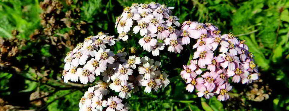
Bird's-foot trefoil, Tom Thumb, Lady's boots, Boots and shoes - Lotus corniculatus, an invasive species in some countries. The flowers are used mainly as a sedative and for other aspects of the nervous and cardiac systems. They have an antispasmodic effect on the digestive tract. In the Sannio region, Italy, the diluted infusions were used to calm anxiety, insomnia and exhaustion. The yellow flowers turn to orange and red as they age. The name derives from the shape of the seed pod, which looks like a bird's foot. This is a foodplant for several butterfly and moth caterpillars. Found on the track side near the above photograph.

A gate along the way, at SX 59451 73681.

A massive stone gatepost with a pair of iron gate hangers.

The track .....

Devonport Leat, at SX 59942 73577, looking north .....

The same location, looking south, showing the clapper bridge over the leat. The field on the right once had a mine, as shown on the Tithe Map (see below).

Just down the slope from Devonport Leat - no idea what this is, a pair of massive walls, the right one appears to be a cavity wall!

1840 Lydford Parish - Forest of Dartmoor Tithe Map (Image copyright Devon County Council) - showing a mine at bottom left in Plot 119 - "Mine piece", close to Bachelors Hall. There is another structure in Plot 116, this being an un-named plot owned (also) by George Nicholson Esquire and leased to William Mitchell, as this appears to have a wheelpit and a stream as a water supply it can inferred that this is the smelting house (see following). There are two lines drawn across the mine area - The left one (through "119") was the original Bachelors Mine Leat that became the prison foul i.e. sewer leat and extended away from the mine. The thinner line (through the "9" of "119") was its replacement, Blackabrook Leat.
Devon & Dartmoor HER - MDV6267 - Bachelors
Hall Tin Mine, Princetown
Site of Bachelor's
Hall Tin Mine. Stamping mill and smelting house built in 1797.
Devon & Dartmoor HER - MDV4735 - Bachelors
Hall Tin Mine
Bachelors Hall Mine was at SX
599 736, being worked in the early 1800s. Identifiable features are
.....
| 1. | A series of small tinpits, possibly contemporary with the early open-cast working of the area. |
| 2. | Three shafts: Footway, Engine and Ann's shafts, running NNE-SSW along the main tin lode. All 3 are now collapsed and capped. |
| 3. | A whim, attached to Engine shaft about 11m in diameter within a bank 3.5m wide, 0.6m high with entrance in the WSW. |
| 4. | Shallow adit, one of 3 adits known to have been associated with the mine. |
| 5. | Two dressing floors with associated earthen platforms for buddles. |
| 6. | Two wheel pits associated with stamps and dressing floors. |
| 7. | The main wheelpit. |
| 8. | A pump-rod gulley from the main waterwheel up to Engine shaft. |
| 9. | The prison, or foul leat. Initially called the Bachelor's Hall Leat and only extending as far as the mine was once the only source of water. After being taken over for use by the prison, mainly for sewage disposal, it was extended south and discontinued from mine use; it is now defunct. |
| 10. | Blackbrook leat - its construction probably necessitated by the original leat being used for the prison. This is also defunct. |
| 11. | Small reservoirs associated with the treatment areas of the mine. |
| 12. | Areas of ridge and furrow cultivation, possibly contemporary with the mine. |
| 13. | The Devonport, or Dock, Leat skirting the east side of the mine. |

Devon & Dartmoor HER - MDV113177 - Bachelor's Hall, Dartmoor Forest - The building is generally accepted as the site of the corn mill and bakery (permission dated 1798 but built post-1809), later converted to a Naphtha Works; the ruin downstream is thought to be a smelting works. Both documentary and map sources indicate the existence of other buildings at Bachelors Hall. Trywhitt built a late 18th century house here and a few years later he was granted a lease to build a corn mill; this suggests two separate buildings. The tithe map and census returns both imply the existence of a farm at Bachelors Hall which if proved would have co-existed with mill cottages for the short duration of the Naphtha Works. A second 19th century Duchy map shows Bachelors Hall as an L-shape building slightly larger than it is today. A building depicted downstream is allegedly the smelting works, and two structures higher up the hillside to the west annotated `Brewery'. The 1839 Tithe Map depicts a building here of L-shape with other buildings and the farm outbuildings more or less as they are today.

Devon & Dartmoor HER - MDV54420 - Corn mill at Bachelor's Hall -
The land lease for the construction of a bakery was granted by the Duchy
on the 20th June 1798, its site being specified as "a
certain building known as Bachelors Hall on the border of a leat lately
made for supplying Plymouth Dock with water". A corn mill and bakery
were built at Bachelors Hall following the establishment of the prison
in 1809. A wier-pool on Bachelors Hall Brook and a leat channel on the
right bank are traceable south of the house, but later structural
alterations have entirely obliterated all exterior vestiges of milling
such as a wheel-pit or axle aperture in the house wall. It is probable
that the now level bed of the stream which gushed through the farm court
wall marks the site of the filled-in wheel pit (at the s end of the
building). In 1844, the British Patent
Naphtha Company was established and the mill was converted into a
peat works for the production of naphtha and tar oil, also the
manufacture of candles and moth-balls. The works were transferred to
Princetown prison after 2 years.
Two mill cottages were recorded
at Bachelors Hall in 1841 and six in 1851. George Caunter farmed
97 acres in 1871 and Oliver Caunter 109 acres in 1881. The last
farmer left in 1944. The signs, in their turn, of milling,
baking, naphtha works, brewing and farming are pre-dated downstream by
those of tin mining.
Possible detour on this walk, down past Bachelors Hall .....

Large building (21 long paces in length) beside the track down to the Blackabrook River, at SX 60150 73723. The track is the elft section of the photograph. The building appears on the tithe map image at the top edge. The Historic Environment Record is not clear regarding this structure - the results of a grid reference search to within 100 metres of the point yield: Bachelors Hall, ditch, adit, tin mill and smelting house. It may be that this is the original house built by Tyrwhitt in the late 1700s and the modern buildings are where there were cottages for mill, bakery or mine workers.

Looking up the Blackabrook River .....

Substantial bridge over the river .....

Looking down the river, showing smaller footbridge over Bachelors Hall Brook .....

Looikng up Bachelors Hall Brook with the modern buildings just visible in top right area of the photograph.
Back on the main track .....

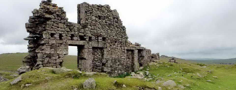
Devon & Dartmoor HER - MDV6389 - Smelting House in the Parish of Dartmoor Forest - A tin smelting house was in operation at 'Bachelors Hall' near Princetown from 1798-1807. It was erected by T Gray in 1795. In the late 1790's, John Swete described the smelting house as 'on the banks of a small stream which emptied into Blackabrook' having stamping mills. Duchy of Cornwall records date from 1798-1804 that indicate 223 ingots were smelted in that period weighing 27.43 tonnes with a further 1.07 tonnes listed for 1807. In sale particulars of 1828, the smelting house had been converted to a brewery. The site of the brewery is shown on the sale plan as being beside the west bank of the stream where agricultural buildings now stand. The photograph above shows the presumed wheelpit for the stamping mill and combines blowing house.
Using these figures: 27.43 tonnes (metric) = 60,346 lbs (UK) = 270 lbs/ingot = 2.4 cwt. That is 2½ bags of cement, poor pack ponies.

Stamping mill / blowing house wheel pit and dressing floors in what is now a small wooded area, at SX 60164 73424.
1887 25-inch Single Sheet OS 25-inch map - shows a 4-sided wheelpit
1892-1914 Series OS 25-inch continuous zoom map i.e. a later "Series" - shows a 3-sided wheelpit.

This fir tree beside the track is quite old - it is more impressive than it looks in this photograph. I didn't think to identify it but it could pre-date the age of the Sitka spruce plantations on the moor.
History of forestry on Dartmoor:
The building of nearby Tor Royal by Sir Thomas Tyrwhitt at Prince's Town
was completed in 1798 and through the first decade of the 1800's there
were experimental plantings of coniferous shelterbelts to protect it.
The Duchy of Cornwall established a plantation at Brimpts in 1862.
Forestry grew after WW1 in an effort to replace the country's greatly
depleted timber stock. By 1930, forestry had been established at
Fernworthy, Bellever, Brimpts, Bear Down and Frenchbeer (Chagford) and
in 1930 these areas were sold to the Forestry Commission (founded in
1919). By 1938, the eastern slopes of Bellever Tor and Lakehead Hill
were planted and the western slopes between 1940-1943. Source: The New
Forests of Dartmoor (1964), London HMSO, Forestry Commission booklet No.
10, pages 6-10.
The tree of choice for planting on Dartmoor is the
Sitka spruce,
Picea
sitchensis, chosen for its high productivity compared
to e.g. Douglas fir, Norway spruce, European larch and other
fast-growing conifers. (text from the walk on
25 February 2018).

Sign at Bull Park to Bachelors Hall .....

Approaching Bull Park, the sign in the previous photograph is seen directly across the track. The track / road on the right comes down from Tor Royal and is part of the TA Tavistock-Ahburton pack horse track.

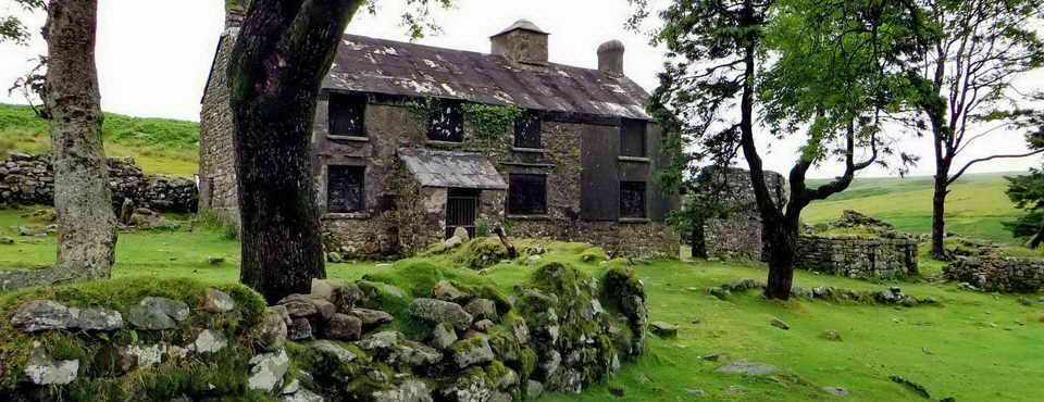
Looking back at Bull Park Farm - built by Sir Thomas Tyrwhitt for a cattle-herdsman (so pre-1833); its enclosures were used to segregate bulls from cows and calves in Cattle Park (where's that?) when required. The last tenant farmer quit on Christmas Day, 1957, and the property became a holiday cottage but is now a private home. The owners told me that the old shed was the bull shed and still has rings in the wall for tying the bulls. Some information from: Eric Hemery (1983), High Dartmoor, Robert Hale, London, page 373.

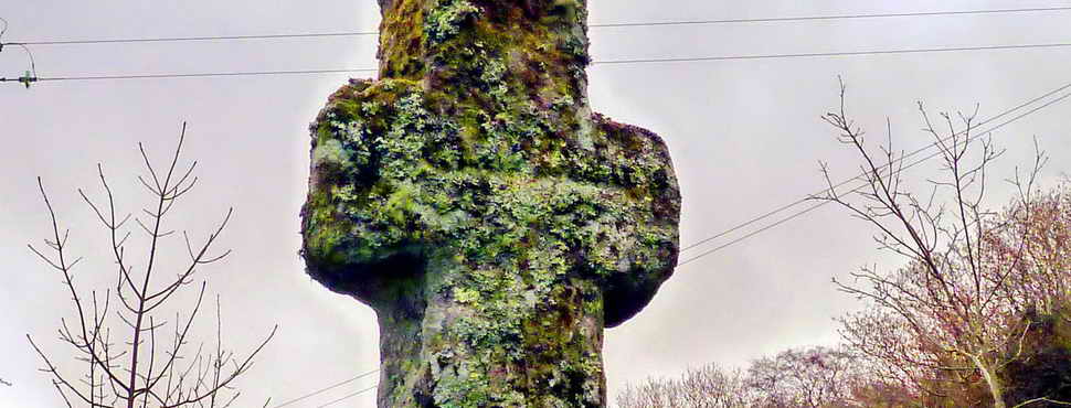
Looking ahead, the start of Conchie Road ascending Bull Park Hill ..... there is a plaque on the left gatepost .....

The plaque.

The track ahead ..... while ascending, look for the eastern highlands - Rippen (79°, 14 km) and Corndon Tors (79°, 8 km) are seen first, followed by Hameldon (50°, 12 km), and then Honeybag (64°, 13.2 km), Chinkwell (66°, 13 km), Bel (90°, 8.8 km), Hey (74°, 17.4 km) (in line with Rippen, Corndon), and Buckland Beacon (89°, 12.7 km). For the westward walker - coming over the top of the hill, they see the trees planted by Tyrwhitt, 1785-1790.

The first junction, at SX 60380 73253 ..... on joining the track at Bull Park, we are on the old Tavistock-Ashburton medieval packhorse track .....

The road goes on a bit .....

Looking back at one point ..... Tor Royal (left) and the tv mast (right) and believed Torgate House (halfway between) .....

Gatepost at SX 60774 73330, long defunct, one of at least two in the area.
Once elevated on Conchie Road, at SX 60838 73213, just before the second road junction, can see .....
|
Longaford
Tor
7° Mag
3 miles
Higher
White
11°
3½ miles
Bellever
46°
3 miles
Hameldown
Tor
50°
7.5 miles
Honeybag
64°
8.2 miles
Chinkwell
66°
8.0 miles
Hey
74°
11 miles
Rippen
79°
9 miles
Corndon
79°
5 miles
|

The second junction, at SX 60875 73201.

Marsh thistle, Cirsium palustre.

Aha, something that puzzled me for over fifty years - it grew as a weed on the family farm, particularly on busy "hard" tracks. I found out in May 2010 that it is Pineapple weed, Matricaria discoidea. It smells like pineapple with a little chamomile when it is crushed, particularly the flower heads. It is a relative of the mayweeds and chamomiles .....

An excursion from the today's route to Blakey Tor and two
cists - not undertaken on this walk because of it being 1.1 km extra and
through long grass during the main tick season.

Blakey Tor West Cist, SX 61235 73545 .....

Approaching Blakey Tor, SX 61279 73633 (this is on the southern edge of the tor for GPS navigation purposes), elevation approx. 365 m (1197 feet) .....

Blakey Tor, the 'prettiest' rock stacks .....

Zoomed view from the tor - is it a logan stone?

Another view.

Blakey Tor East Cist, SX 61306 73550 ..... cist 1 in the figure below (cist 2 being the west cist seen above, about 80 metres away). These cists have no retaining kerbs or covering cairns. The two cists are described briefly by J. Butler (1993), Dartmoor Atlas of Antiquities IV, The South-East. 65.4 Blakey Tor cairns (fig. 65.5), pages 230-231.

Image © J Butler
1993. Reproduced by kind permission (ref. 29 Sept. 2012).

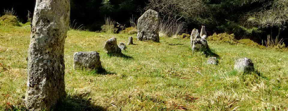
The Crock of Gold cist, SX 61282 73068, described by J. Butler (1993), Dartmoor Atlas of Antiquities IV, The South-East. 65.2 Cholake settlement and Crock of Gold cairn (figs. 65.3, 3.1), pages 229-230. Royal Hill behind - is that clump the summit?

Showing the cist, the displaced capstone and the encircling retaining kerb stones i.e. a ring cairn .....

Looking into the cist .....

Another view .....

Surprisingly deep ..... the depth was measured on Recce-2 as being 0.74 metre / 2 ft 5 inches .....

Image © J Butler
1993. Reproduced by kind permission (ref. 29 Sept. 2012).

The group at the Crock of Gold cist on what was the hottest July day on record (38.1° in Cambridge). On Dartmoor it was a balmy 23° with some breeze and a few shady spots for us! Unfortunately two of our group only appeared after we left the cist, having been caught up with an accident, road works and blocked roads. Luckily I could return with them to the cist.

Heath bedstraw, Galium saxatile - widespread in the area, small flowers, grows in clumps.

Holes in the ground nearby.

Royal Hill summit cist, SX 61297 72792.

A Merlin helicopter passed over as we walked back.

The Duchy Hotel, built 1809-1810, for officers guarding the French POWs at the War Prison. It was modernised in 1908 and 1914. It is now the National Park Visitor Centre since 1993 and home to the Duchy of Cornwall (Dartmoor) Office and Dartmoor Preservation Association - Friends of Dartmoor.

Princetown war memorial, with WW1 soldier silhouettes.

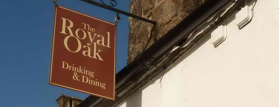
The second of the two 1908 now-defunct drinking fountains, beside the Prince of Wales public house on Tavistock Road leading to the prison .....

The Prince of Wales public house - the drinking fountain can just be seen at the right edge.
MAP: Red = GPS satellite track of the walk.

© Crown copyright 2016 Ordnance
Survey
Licence number 100047373
Also, Copyright © 2005, Memory-Map Europe, with permission.
This walk was reached by parking in Princetown, in this case at The Plume of Feathers public house by negotiation. The group then returned to the main road and walked towards Two Bridges, turning off the road through the gate adjoining the next-to-last house on the edge of the village.
Statistics
Distance - 5.96 km / 3.70 miles
All photographs on this web site are copyright
© Keith Ryan.
All rights reserved - please
email for permissions