![]()


6his walk: 2016-8-26. Rees Jeffreys car park, Grimstone and Sortridge Leat, clapper bridges, Vixen Tor, aqueduct, cairns, wheelwright's stone, blacksmith's shop, Barn Hill. cists, Beckamoor Cross / Windypost, Middle Staple Tor, Great Mis Tor, cider press, Feather Tor, trough, Heckwood Quarry, parish boundary stones, Saddle Rock.
Walk details below - Information about the route etc.
Previous walks in this area: 3rd November 2010 and 11th July 2012.
Link to Google Satellite view of the area including the GPS track of the walk (compare with the Ordnance Survey map plus track below)
Old maps
Ordnance Survey, Six-inch to the mile, 1st edition - 1888-1913

Plaque in the car park mentioning the Rees Jeffreys Road Fund - this links to their web site! See also William Rees Jeffreys, the man, who was responsible for roads being classified as "A" & "B" roads. Photo from the walk on 3rd November 2010, before the sign became aged and was vandalised.

Clapper bridge at SX 53940 74816 on the Grimstone and Sortridge Leat.

Second clapper bridge at SX 53742 74873.

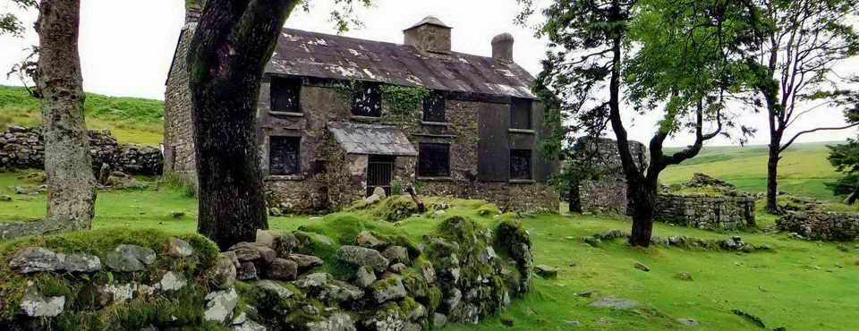
Somewhere here are the remains of a medieval longhouse, although it seemed impossible to find any walls in the dense bracken, come back in winter?

Zoomed view to Vixen Tor, the Dartmoor Sphinx (details below).

The stream in Beckamoor Coombe, where the Grimstone & Sortridge Leat crosses the stream, Beckamoor Brook, by means of an aqueduct .....

Another view .....

John Wills 1953-1987 .

Cairn / cist at SX 53437 75006: the veracity of this being a cist is questionable although it has the features of a burial cairn. Source: J. Butler (1994), Dartmoor Atlas of Antiquities Vol. 3 - The South West, 3 - Reaves and cairns on Whitchurch Common (fig. 44.7.9.3), pages 33-34. This cairn is no. 4 in the figure below. Another such cairn, seen later on this walk, is no. 2 in the figure.

A view of ther dug-out centre of the cairn, "4" .....

Image � J Butler
1994. Reproduced by kind permission (ref. 29 Sept. 2012).

Wheelwright's form for putting precision-fit, red hot iron tyres onto wooden wagon wheels and then quenching them in the nearby leat before the wheel caught fire. GPS location: SX 53616 74772 ..... the leat can be seen running alongside, with a clapper bridge .....

The stone has a central depression to accommodate the hub of the wheel .....

Blacksmith's Shop on the northern slope of Barn Hill, all part of Whitchurch Common along with Heckwood and Feather Tors ..... it was at this spot in 1858 that John Bickle was caught and arrested for the attempted murder of Joanna Bolt at Huckworthy Bridge School House: Source: Mike Brown (2001) Guide to Dartmoor, CD-ROM, Dartmoor Press, Grid Square 5358 7473. The smithy was here to look after the needs of the sett-makers, stone-cutters and waggoneers working in the quarry, keeping tools sharpened, setting iron tyres on the wooden wagon wheels etc.

Zoomed view up Barn Hill, not the summit.

Middle Staple Tor (centre, SX 5403 7564, elevation 431 metres /1414 feet)), Little Staple Tor (Little Staple Tor, SX 5386 7536, elevation 380 metres /1246 feet) can be seen a little below and left of centre, The top of Great Mis Tor can bee seen at the right edge: Great Mis Tor, SX 563 769, elevation 538 metres (1765 feet)..

Zoomed view of Middle Staple Tor.

Great Mis Tor.

Middle Staple Tor (left) with Little Staple Tor a little clearer, below it, and Great Mis Tor (towards the right).

Barn Hill.

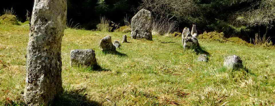
Barn Hill cist, SX 53316 74552, looking back up to the top of the hill .....

Barn Hill South cist / cairn at SX 53316 74552, described by J. Butler (1994), Dartmoor Atlas of Antiquities III, 44.10.3 with a plan and map on page 34 and a record on page 206. A second cist is described as Barn Hill N.E. at SX 5343 7503 ..... actually more of a cairn (see near the begining of this walk, no. "4" on the figure above. This is cist is labelled as "cist 3" on the sketch map.

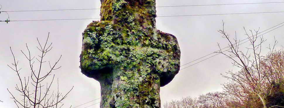
Grimstone & Sortridge Leat, with Beckamoor or Windy Post Cross: a difficult-to-see Ordnance Survey benchmark is incised into the cross on its southern face, it can be seen. .

The bullseye stone that limits the water taken off to supply farms etc. - more description can be found here.

Attempted photograph of the surveyor's bench mark from the walk on 28th December 2011.

A Windypost scene .....

Another scene.

Raucous carrion crow taking a bath.

An edge view of a rock that was split by the wedge and groove method. ....

The wooden wedge method was replaced by the more efficacious feather and tare method around 1800.

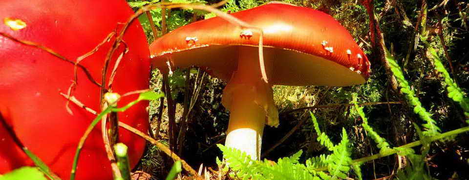
What is that growing in wedge and groove grooves!

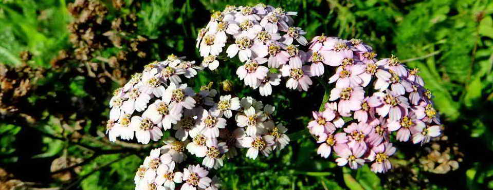
Common heather, also known as ling.

Family group of Dartmoor ponies.

A discarded apple crusher at SX 53475 74070, believed damaged. Is this the wheel that would have run around inside the circular trough to crush apples for cider-making? Showing the location of the cider press in relation to Feather Tor: SX 535 741, elevation 313 metres (1026 feet).

Looking back at Feather Tor.

A broken trough, at SX 53742 73908, this probably resulted in a little cursing!

Showing the trough in relation to a nearby solitary tree, the trough is about 12 metres away (not measured) on a bearing of 150� from the tree. There is a lot of bracken here!

Heckwood Man, appearing over the horizon as we ascended the slope of Heckwood Tor .....

This is a very characterful rock, with interesting horizontal bedding planes, but what is seen to the right? Are they vertical (slanted) vertical joints or is that a toppled stack?

Contact points underneath Heckwood Man, this could almost be a logan stone that rocks on and off the page (not left/right, though).

Heckwood Tor, SX 537 738, elevation 321 metres (1053 feet).
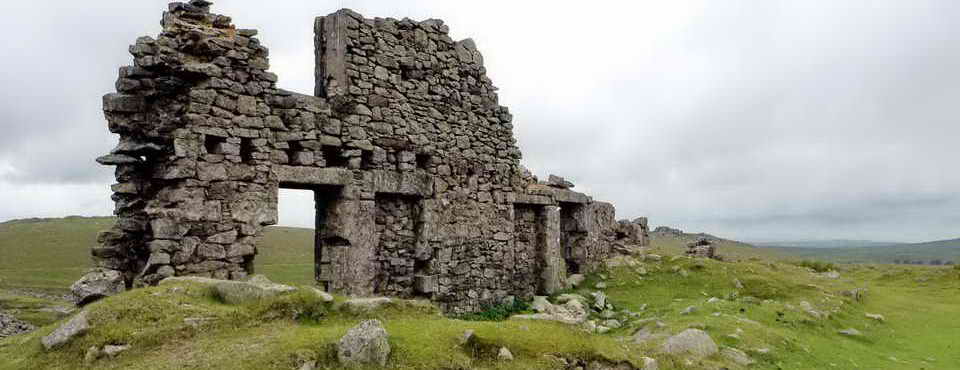
 Scene
in Heckwood Quarry, one finished granite block (centre) and one rough one
(behind, left). It is said (Hemery, page 1007, citing Crossing) that these
blocks were destined for Plymouth Breakwater. Weights: 1 cu.ft. of granite weighs 175 lbs. 1 hundredweight (cwt) is
112 lbs. From photos with people, it is estimated that this block is 6 x 2
x 2 feet = 24 cu. ft. = 4200 lbs. = 37.5 cwt = 1 ton 17.5 cwt, or almost 2
tons. The breakwater blocks in the aerial image are said to weigh 100
tons and are made of concrete, so these notions do not agree; unless this is not
one of the free-standing blocks.
Scene
in Heckwood Quarry, one finished granite block (centre) and one rough one
(behind, left). It is said (Hemery, page 1007, citing Crossing) that these
blocks were destined for Plymouth Breakwater. Weights: 1 cu.ft. of granite weighs 175 lbs. 1 hundredweight (cwt) is
112 lbs. From photos with people, it is estimated that this block is 6 x 2
x 2 feet = 24 cu. ft. = 4200 lbs. = 37.5 cwt = 1 ton 17.5 cwt, or almost 2
tons. The breakwater blocks in the aerial image are said to weigh 100
tons and are made of concrete, so these notions do not agree; unless this is not
one of the free-standing blocks.

Another view of the finished block.

Google Earth image of the blocks on the outer face of Plymouth Breakwater. Comparison of the visible blocks and the image scale reveals that these blocks are close to 6 metres in length, not 6 feet like the granite blocks the quarry.
From the Cyber Heritage web site, A Look at the Plymouth Breakwater: Large concrete blocks placed on outside, south, side of Plymouth Breakwater c1971..and a few of the collection of blocks in 1994. Each block weighs 100 tons.

The "rough" block.

General view into Heckwood Quarry.

Our joke was that when the bull has finished his work then he must be Dun Roaming?
 "SS
"SS P" denoting Sampford Spiney Parish ..... at SX 54036 73978
"SS
"SS P" denoting Sampford Spiney Parish ..... at SX 54036 73978

"WB" (Whitchurch Bounds): all the stones in the area are described by Dave Brewer (2002) Dartmoor Boundary Markers, Halsgrove, p. 168. This is stone BS11 or "d" .....

Vixen Tor as seen from the south-west.

Common heather, also known as ling.

Saddle Rock, a large natural boulder, inscribed "SB" on the left vertical face, SX 54085 74409 ..... labelled as "Stone 1" and "C" by Brewer (page 167) .....

The inscription was not very discernible in the lighting of the day; it is recorded on page 168 of the Brewer reference given above.

A set bound stone in the wall around Vixen Tor: "SB" denoting Sampford Bounds i.e. Sampford Spiney Civil Parish boundary, this is set almost in Vixen Tor Newtake wall at SX 54133 74363 ...... Source: Dartmoor Boundary Markers, Dave Brewer, Halsgrove, 2002, page 166 .....

The other side of the stone, with "WB" denoting Whitchurch Bounds i.e. Whitchurch Civil Parish boundary .
 Vixen Tor SX
542 742, elevation 317 meters (1040 feet). The stack is about 30 metres (100
feet) in height. There
is a legend about the witch,
Vixana,
who lived on Vixen Tor. The "Vixana" link leads to a more civilised version of
the story: the real story was about the son of the King of the Piskies and also
that Vixana would bite off the fingers of the hapless travellers as they sank,
misled by her, into the Vixen Tor Mire. Her eventual demise, when she herself
was caused to fall into the mire ended with the fingerless hands of all her
victims rising from the mire to pull her under. There then followed a series of
rainbows that ended in the mire and the rising of the lost souls, up the rainbow
to heaven.
Vixen Tor SX
542 742, elevation 317 meters (1040 feet). The stack is about 30 metres (100
feet) in height. There
is a legend about the witch,
Vixana,
who lived on Vixen Tor. The "Vixana" link leads to a more civilised version of
the story: the real story was about the son of the King of the Piskies and also
that Vixana would bite off the fingers of the hapless travellers as they sank,
misled by her, into the Vixen Tor Mire. Her eventual demise, when she herself
was caused to fall into the mire ended with the fingerless hands of all her
victims rising from the mire to pull her under. There then followed a series of
rainbows that ended in the mire and the rising of the lost souls, up the rainbow
to heaven.

Vixen Tor cist, SX 54232 74401 .....

A fine, example of cist ("kistvaen" = stone box) construction .....

Another view.

Vixen Tor, aka The Dartmoor Sphinx, SX 542 742, elevation 317 meters (1040 feet). The stack is about 30 metres (100 feet) in height .....

Zoomed view.

An inconspicuous burial cairn at SX 54167 74455, easily overlooked.

The last boundary stone visited on this walk, at SX 54004 74804, labelled as "Stone 2" by Brewer (page 167 and 169) .....

The stone is inscribed "SB", if you can see it!

This stone has incision marks near ground level. I have heard it referred to as Clove or Cloven Saddle Rock, but I have found no reference to this in the standard references (Brewer, Hemery, Brown, Thurber or Crossing's Guide) although Brewer mentions "Saddle Clove Rock" in the index, on pages 173-174, but I do not see it there nor on adjacent pages. Mike Brown's CD-ROM Guide to Dartmoor records a Clove Stone Rock among the boundary markers of Widecombe Town, one of seven manors in Widecombe Parish. Brewer also records Saddle Clove Rock, or Clove Stone, as a marker for Natsworthy Manor at SX 7315 7833, on page 83.
MAP: Red = GPS satellite track of the walk.

� Crown copyright and database rights 2016 Ordnance
Survey
Licence number 100047373
Also, Copyright � 2005, Memory-Map Europe, with permission.
This walk was accessed by parking at the Rees Jeffreys car park marked on the
map by the P symbol
and the
yellow cross. This is about 1 km west of Merrivale on the Two Bridges-Tavistock
road.
Statistics
Distance - 5.9 km / 3.8 miles
All photographs on this web site are copyright © 2007-2016 Keith Ryan.
All rights reserved - please email for permissions