![]()


Windswept tree close to SX 62478 61873. Some of these trees in the hedge certainly lean out on the lee side of the hedge

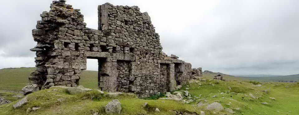
Settlement at SX 62298 62445 in the mid distance. It looks like a lot of stones from this vantage point. Note the sky darkening in that direction .....

Rain water running off the moor beside the settlement over ordinary grass. This was not a regular stream and indicates the amount of rain that fell over the weekend (this was on Monday 5 March)

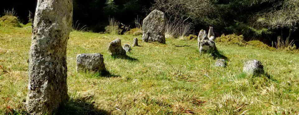
Hut circle in the settlement

Another settlement on the next hill at SX 62015 63593 with the head valley of the River Yealm to the left, parts of the Yealm Steps Waterfall are showing white

Close-up of the settlement, digitally altered to show the walls etc more clearly

Ranny Brook falls at approx SX 62143 63313

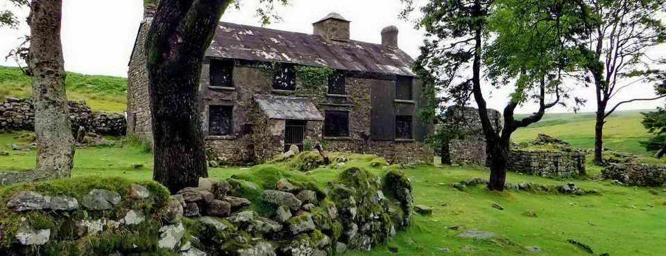
View of the blowing house towards the right on the head waters of the River Yealm at SX 61780 63515. The river is to the left

Closer view of the blowing house - unfortunately I omitted to take stereo pairs of this

Mould stone in the blowing house for casting molten tin into ingots for carrying off the moor

View of Yelam Steps Waterfall at approx SX 61740 63645

Yealm Steps
All map references above are from a product for Dartmoor & Exmoor
The walk was planned for 11.5 km / 7.1 miles but it was cut short when rain set in .....

Reproduced from Dartmoor OS Explorer map 1:25 000 scale by
permission of Ordnance Survey
on behalf of The Controller of Her Majesty's
Stationery Office.
© Crown copyright. All rights reserved. Licence number WL 10021.
Also, Copyright © 2005, Memory-Map Europe, with permission
Access was via Cornwood and Torr at SX 62522 61124. Cornwood is at the bottom left corner of the map.
The approach was much the same as for walk 2007-2-21 to West Beacon although the final approach did not seem as narrow as the final approach that time, which was to Harford Moor Gate.
The walk was cut short due to bad weather coming in from the west after I reached Yealm Steps. I photographed "SETL2" (the second Settlement) on the map from the hill before it but did not actually go that far on the route. The planned route is shown in BLUE on the map, and the outward and return "tracks" are shown in RED. The strange labels on the map are the names entered onto the GPS unit. You can see slight wanderings as I looked for items mentioned below!
NB - If anyone finds a full bent apple shape Peterson pipe model #303 complete with shiny metal wind cover on a rock - its mine! I put it down to take some photographs and forgot to pick it up again.

.
All photographs on this web site are copyright ©2007-2016 Keith Ryan.
All rights reserved - please email fopermissions